Hickman Bridge Trail in Capitol Reef National Park, Utah, is a moderate 1.8-mile round-trip hike leading to a spectacular natural sandstone bridge, with roughly 400 feet of elevation gain and beautiful views of the surrounding desert landscape. Most visitors should allow around 1.5 to 2 hours for hiking, photographs, and short stops. The route is an excellent choice for travelers who want to experience Capitol Reef’s geology without committing to a full-day backcountry hike.
The trail follows exposed desert terrain near Utah State Route 24, climbs through sandstone formations, and passes features connected to the area’s natural and cultural history. Before leaving, review the official Capitol Reef National Park trail guide for current trail information.
This practical guide explains how to reach the trailhead, what to expect along the route, when to hike, what to pack, and how to avoid common mistakes. It also includes a realistic half-day itinerary and nearby options for extending your visit.

1. Hickman Bridge Trail Capitol Reef National Park: Quick Overview
The hike is a moderate, approximately 1.8-mile round-trip walk with about 400 feet of elevation gain, ending at a large natural sandstone bridge. It suits reasonably active visitors who are comfortable walking on uneven ground and climbing exposed sections.
| Trail detail | What to know |
|---|---|
| Location | Capitol Reef National Park, Utah, USA |
| Round-trip distance | Approximately 1.8 miles (2.9 km) |
| Elevation gain | Approximately 400 feet (122 m) |
| Difficulty | Moderate |
| Typical visit | About 1.5–2 hours, depending on pace |
| Trail surface | Uneven dirt, rock, slickrock, and stone steps |
| Trailhead access | Near Utah State Route 24 |
| Reservations | Check current National Park Service guidance; ordinary day hiking does not generally require a trail reservation |
| Pets | Pets are not permitted on this hiking trail |
Distances and times are planning estimates, not guarantees. Check the National Park Service moderate hiking guidance and the current park trail guide before setting out.
The main attraction is the natural bridge, but the journey also provides opportunities to notice changing rock textures, desert vegetation, and the broader Waterpocket Fold landscape. Bring enough time to appreciate these details rather than treating the hike as a quick walk to a single viewpoint.

2. How to Reach the Hickman Bridge Trailhead
The Hickman Bridge trailhead is located along Utah State Route 24, east of the main visitor center in the Fruita area. Driving is the most practical way to reach the trailhead because public transportation within the park is limited.
Driving from the visitor center
Start at the Capitol Reef National Park Visitor Center near the junction of Utah State Route 24 and the Scenic Drive. Follow the park’s signed directions toward the Hickman Bridge trailhead. Use official signs rather than relying entirely on a navigation app, particularly where mobile reception is weak.
The parking area is relatively small compared with popular trailheads in larger national parks. Arriving early helps you avoid the busiest period, find a legal parking space, and start hiking before the strongest afternoon heat.
Driving from Torrey, Utah
Torrey is a common base for visiting Capitol Reef. From town, follow Utah State Route 24 toward the park and continue to the signed trailhead. Allow extra time for stops, road conditions, and visitor-center information.
If your itinerary includes several parks in southern Utah, review our guide to planning a national park weekend trip before deciding how much driving to combine with hiking.
3. What to Expect on the Hickman Bridge Hike
Expect an initial climb, exposed desert terrain, rock formations, and a final approach that reveals the natural bridge from below. The short distance can be misleading because the trail gains elevation and offers limited shade.
Start with the initial climb
The trail begins near the Fremont River corridor and climbs away from the road through an arid landscape. Take a steady pace, especially if you have arrived from a low-elevation destination.
Stop when necessary to drink water and catch your breath. The elevation and dry air can make the effort feel greater than the distance suggests.
Notice the geology and cultural history
Capitol Reef’s rock formations preserve a long geological history. Erosion, water movement, and the uplift of the Waterpocket Fold helped create the area’s distinctive cliffs, domes, and natural openings.
The wider area also contains archaeological resources associated with Indigenous peoples, including ancestral Fremont cultural remains. Treat these places with care: do not touch, remove, climb on, or disturb archaeological materials. Follow posted closures and interpretive signs.
Approach Hickman Bridge
The route reaches the natural sandstone bridge after a series of climbs and bends. The bridge is an impressive example of erosion shaping rock into an opening that spans the landscape.
Remain on the designated trail and view the formation from permitted areas. The top of Hickman Natural Bridge is closed to public access. Climbing onto the bridge creates fall and falling-debris risks and can damage fragile natural features.

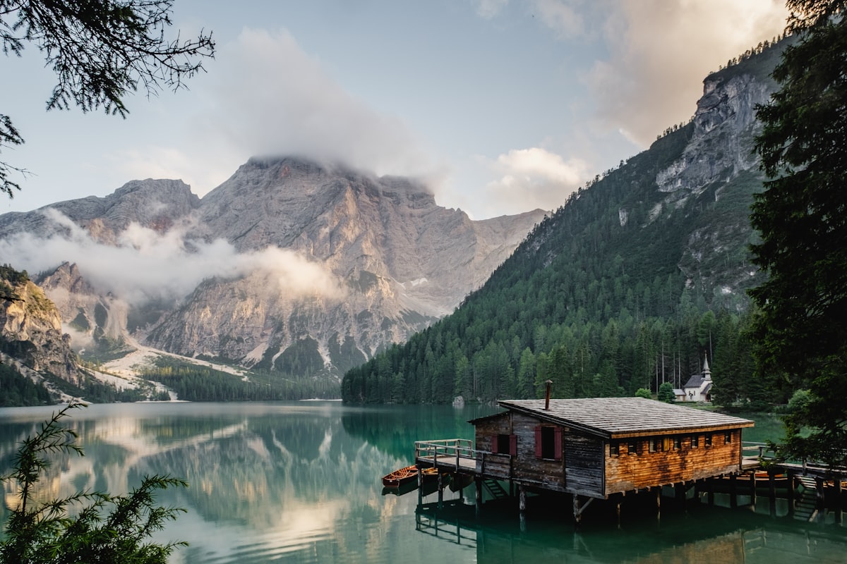
For a reliable description of the official route, consult the Capitol Reef National Park trail guide. Do not assume that an image from another Utah park accurately depicts the bridge or its exact trail conditions.
4. When Is the Best Time to Hike Hickman Bridge Trail?
Spring and autumn often provide comfortable hiking conditions, while early mornings are generally preferable during hot weather. However, the best day depends on the current forecast, trail conditions, and the possibility of storms.
Spring: changing temperatures and fresh scenery
Spring can bring pleasant hiking weather, although mornings may be cold and conditions can change quickly. Dress in removable layers and check for rain, snow, and muddy sections before leaving.
Summer: start early and manage heat
Summer temperatures in Capitol Reef can become extreme, and exposed trails provide little shade. Start early, carry adequate water, and shorten or cancel the hike if the heat exceeds your ability to manage it safely.
Summer also overlaps with the regional monsoon season. Thunderstorms can create dangerous flash floods even when the trailhead itself appears dry.
Autumn: comfortable days and shorter daylight
Autumn can be a rewarding time to explore the Fruita area, but cool mornings and changing daylight require preparation. Check sunset time and leave enough margin to finish before dark.
Winter: cold weather and potentially slippery rock
Winter visits can offer quieter conditions, but snow, ice, and freezing temperatures may make exposed rock unsafe. Do not attempt a section that looks slippery or requires climbing beyond your comfort level.
Pro tip: Check the official park alerts and conditions page on the morning of your visit. A previously open route can become unsafe or inaccessible after weather changes.
5. What to Pack for Hickman Bridge Trail Capitol Reef National Park
Carry water, sun protection, suitable footwear, food for your outing, and a way to navigate without dependable mobile reception. Pack for the actual weather rather than assuming a short hike requires little preparation.
- Water: Bring enough for every person, accounting for heat, exertion, and the time spent outdoors. There may be no drinking water available at the trailhead.
- Footwear: Wear hiking shoes or sturdy footwear with good traction for uneven rock, loose gravel, and dusty surfaces.
- Sun protection: Use a wide-brimmed hat, sunglasses, and sunscreen.
- Food: Carry a snack, especially if you plan to explore other trails afterward.
- Navigation: Download offline maps and keep a written or saved record of your route.
- Weather protection: Carry an appropriate layer and rain protection when conditions warrant it.
- Emergency supplies: Bring a small first-aid kit, a charged phone, and any personal essentials you may need.
- Waste bag: Take all rubbish back out with you.
There is no universal water quantity that is right for every hiker. Heat, body size, fitness, pace, and medical needs all affect hydration requirements. If conditions are unusually hot or you cannot carry sufficient water, choose a safer, shorter activity.
For more trip-planning advice, see our USA travel planning guide and review the National Park Service’s Capitol Reef hiking guidance.
6. Essential Safety Rules for the Trail
The most important precautions are to avoid storms and exposed wet rock, stay on the official trail, carry sufficient water, and respect all closures. Short hikes can still involve serious hazards in an exposed desert environment.
Understand flash-flood risk
Flash floods can occur after intense rainfall, including rainfall outside the immediate area. Dry washes and narrow drainage areas can fill quickly with fast-moving water and debris.
Check the forecast and the park’s flash-flood guidance before starting. If thunderstorms are forecast or threatening weather develops, postpone the hike or select a safer alternative outside exposed drainage areas. Never enter floodwater or attempt to cross a flooded wash.
Stay away from cliff edges
Loose gravel, uneven rock, and steep drop-offs can turn a small mistake into a serious accident. Keep a safe distance from edges, supervise children closely, and never leave the marked trail to obtain a photograph.
Protect natural and cultural resources
Leave rocks, plants, fossils, and archaeological objects where you find them. Do not carve into sandstone, disturb cultural sites, or climb onto the natural bridge. These restrictions protect both visitors and the features that make the park special.
Know when to turn around
Turn back if someone in your group becomes overheated, runs low on water, develops an injury, or feels unsafe on the terrain. Reaching the destination is less important than returning safely.
Read the National Park Service flash-flood safety guidance and official Capitol Reef safety information before departure.

7. A Practical Half-Day Itinerary for Hickman Bridge Trail
A useful half-day plan combines an early trail start with time for the visitor center, scenic stops, and a relaxed meal in the Fruita area. This approach keeps the hike as the main activity without forcing several demanding trails into one morning.
| Time | Activity | Planning advice |
|---|---|---|
| 7:30 a.m. | Arrive near the trailhead | Check parking, weather, and trail conditions. |
| 7:45 a.m. | Begin the hike | Set a pace suitable for the slowest member of your group. |
| 8:30–9:00 a.m. | Explore the bridge area | Photograph the formation from permitted locations. |
| 9:00–9:45 a.m. | Return to the trailhead | Allow extra time for rest and uneven terrain. |
| 10:00 a.m. | Visit the visitor center | Check ranger information and any updated notices. |
| 10:30–11:30 a.m. | Explore the Fruita area | Choose a suitable scenic stop or short walk. |
| Late morning | Eat and plan the next stop | Keep the remainder flexible for weather and fatigue. |
These times are an example rather than a guaranteed schedule. The hike may take longer with children, frequent rest stops, heat, or difficult trail conditions. Do not rush to follow the itinerary if safety conditions change.
If you are travelling with family, browse our national parks for families guide for broader trip-planning ideas. Confirm trail suitability for every member of your group instead of assuming a moderate rating guarantees an easy outing.
8. Nearby Trails and Activities Worth Considering
Capitol Reef offers several other hiking and sightseeing options, but the right addition depends on your available time, fitness, weather, and current access conditions. Choose one suitable activity rather than trying to cover the whole park in a single visit.
Rim Overlook Trail
The Rim Overlook route continues from the Hickman Bridge and Navajo Knobs trailhead area and involves a substantially longer and more strenuous outing. The National Park Service lists approximately 2.3 miles one way and around 1,110 feet of elevation gain for the overlook route. Confirm the current route description before combining it with Hickman Bridge.
This extension is best suited to hikers who have sufficient time, fitness, water, and confidence on exposed terrain. It is not a casual add-on for every visitor.
Grand Wash
Grand Wash is known for its dramatic canyon walls and narrow passages. Conditions can change after rain, and flash-flood hazards are particularly important in canyon terrain. Check the current alerts before travelling to the access point.
Goosenecks Overlook and Sunset Point
These shorter walks and viewpoints can be useful alternatives when you want scenery without committing to another long hike. Verify access and road conditions before setting out, and do not assume every viewpoint is accessible during adverse weather.

For official route distances and descriptions, use the Capitol Reef trail guide rather than relying on an old itinerary or an unverified map listing.
9. How Much Does a Hickman Bridge Trail Visit Cost?
The hike does not ordinarily require a separate trail reservation, but visitors must account for the applicable Capitol Reef National Park entrance fee or valid pass. Transportation, accommodation, food, and any additional activities are separate costs.
Plan the main expenses
- Park entry: Check the current official entrance-fee and pass information before travelling. Fees and pass eligibility can change.
- Fuel: Calculate the round-trip distance from your accommodation and include additional scenic drives.
- Accommodation: Compare lodging in Torrey with any available campground options. Check current availability and booking requirements.
- Food and water: Bring supplies or budget for meals and groceries before entering more remote areas.
- Equipment: Include any footwear, sun protection, or hiking supplies you need to purchase.
For a transparent budget, total your actual expenses rather than relying on a generic estimate that may not match your travel dates or group size. If you plan to stay overnight, review our hotel and accommodation planning resources.
Make a simple trip budget
| Expense | Your estimate |
|---|---|
| Park entrance or pass | Check current official rates |
| Fuel and transport | Calculate for your route |
| Food and drinking water | Estimate per person |
| Accommodation | Confirm current prices |
| Equipment and contingency | Allow for your specific needs |
Do not assume that a low-cost visit is automatically a safe visit. Carrying sufficient water, using suitable footwear, and allowing time to turn around are more important than saving a small amount on preparation.
Frequently Asked Questions About Hickman Bridge Trail
These quick answers cover the most common planning questions about distance, difficulty, timing, access, and safety. Open each question for the details.
How long is Hickman Bridge Trail in Capitol Reef National Park?
The hike is approximately 1.8 miles (2.9 km) round trip. Allow around 1.5 to 2 hours for walking, resting, and enjoying the scenery, with additional time if your group needs a slower pace.
Is Hickman Bridge Trail difficult for beginners?
The trail is rated moderate, with approximately 400 feet of elevation gain. Beginners who are comfortable on uneven terrain may enjoy it, but the exposed sections, climbing, and limited shade can make it challenging in hot weather.
Can you walk on top of Hickman Natural Bridge?
No. The top of Hickman Natural Bridge is closed to the public because of fall hazards, potential falling debris, and resource-protection concerns. Stay on the designated trail and use permitted viewpoints.
What is the best month to hike Hickman Bridge Trail?
Spring and autumn often offer comfortable temperatures, but conditions vary from day to day. Check the forecast and park alerts before choosing a date, and start early during hot weather.
Is there drinking water at the Hickman Bridge trailhead?
Do not rely on finding drinking water at the trailhead. Bring enough water for your group and the expected weather, and confirm available visitor services before departure.
Are dogs allowed on Hickman Bridge Trail?
Pets are not permitted on this hiking trail. Review the park’s official pet rules before bringing an animal to Capitol Reef, as permitted areas and restrictions differ by location.
Do you need a reservation to hike Hickman Bridge?
Ordinary day hiking generally does not require a separate trail reservation. However, applicable park entrance fees or passes, access restrictions, and temporary closures still apply. Verify current rules on the official National Park Service website.
Is Hickman Bridge Trail safe during rain?
Rain and thunderstorms can create dangerous conditions, including flash floods, slippery rock, and poor visibility. Postpone the hike when storms threaten, and follow official weather and safety guidance.
Can you combine Hickman Bridge with other Capitol Reef hikes?
Yes, if you have enough time, water, daylight, and fitness. The Rim Overlook route is a more strenuous extension, while shorter viewpoints may suit a relaxed itinerary. Check current trail and road conditions before combining routes.
Is Hickman Bridge Trail suitable for children?
Some families can complete the hike, but suitability depends on children’s ages, stamina, coordination, weather, and comfort with exposed terrain. Supervise children closely near steep sections and be prepared to turn back.
Final Takeaway: Plan a Better Hickman Bridge Hike
Hickman Bridge Trail is a rewarding way to experience Capitol Reef National Park’s sandstone geology on a relatively short but moderately challenging hike. Start early when practical, bring sufficient water, check the weather, and stay on the designated route.
Before departure, check official trail conditions, entrance requirements, and flash-flood guidance. Build a flexible itinerary around the hike rather than trying to fit too many activities into one day.
With realistic preparation and respect for the park’s natural and cultural resources, you can enjoy the landscape while helping preserve it for future visitors.
Official Resources and Further Reading
- National Park Service: Capitol Reef trail guide
- National Park Service: Hiking at Capitol Reef
- National Park Service: Current alerts and conditions
- National Park Service: Flash-flood safety
- National Park Service: Entrance fees and passes
- Visit Utah: Hickman Bridge and Navajo Knobs
Travel information is provided for planning purposes. Trail conditions, fees, weather, access, and park regulations can change; confirm details with the responsible authorities before travelling.